MARLDON’S RIGHTS OF WAY
The following Rights of Way descriptions have been researched by Marldon Environment Group members Ray Bond and Barry Heaselden and are intended as a helpful guide only for users.
Click on each numbered link below for a detailed description of the footpath, bridleway or unclassified road.


Bridleway – 
Unclassified Road – 


The following types of Rights of Way are in use in the Parish of Marldon

 – a footpath may be used only for walking
 – a bridleway may be used for riding or leading a horse as well as for walking (cycling is also permitted providing cyclists give way to riders and walkers)
 – an unclassified road (usually with an unmade surface), may be used for walking, leading or riding a horse or cycling but over which there is also a right to use any kind of wheeled vehicle
Changes and improvements will occur from time to time and so detailed path descriptions which follow are not meant to be absolute.
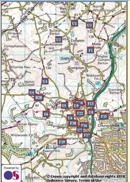
 The Blue line indicates the Marldon boundary
 The markers show the location of the footpaths, bridleways and unclassified roads and, by clicking on the corresponding marker button at the top of the page, footpath descriptions and a location map will also appear (a dashed red line indicates the footpath).
