HomeFootpaths & Green Lanes Footpaths & Green Lanes 
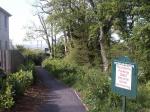
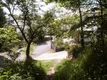
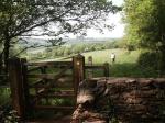
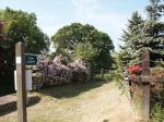
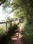
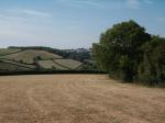
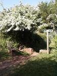
FOOTPATHS IN MARLDON – BEATING THE BOUNDS Just a few images of some public footpaths and rights-of-way, maintained in general by volunteers in our Marldon Environment Group.
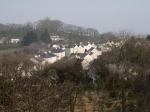
 Old Ring Road (UCR) – now unused by vehicles, adjacent to Broomhill Meadow and loved by walkers and dogs alike. Footpath 16 – crossing over land that was once part of Pontin’s Torbay Chalet holiday camp, a short-cut between houses and Leader Lane. Slip Hill (UCR) – once thought to be part of the Ipplepen Road, this un-driveable section is just a few metres in length. Smallwell Lane (UCR) – runs along the edge of Marldon towards Aptor and beyond Footpath 5 – this Kissing Gate is at Strainy Tor next to an old stone stile, providing easy access for all. Footpath 22 – running between Marldon Cross Hill and Nether Meadow, alongside Peter’s Field. Footpath 18 – this pleasant path with views over Dartmoor runs alongside the Christmas Tree Farm between Moorview and Farthing Lane. Footpath 5 – with views towards Wildwoods this section of the path at Marldon Tor is close to the centre of the Parish. Bridleway 20 – popular with horse-riders, this picture seems to be aptly approved. Footpath 17 – again at Churscombe, gates both old and new mark where the path joins Leader Lane Footpath 17 – the houses of Furzegood and nearby Moorview show up clearly in the valley. Footpath 1 – from here this path provides some stunning views back towards Marldon Village. Footpath 17 – at Churscombe this path provides views towards Beacon Hill. Footpath 6 – the right-of-way path is clearly signed around the edge of the field at Burrow Orchard as it continues to Loventor. Footpath 13 – at the Chittlebury junction an oak bench marks where the path joins a section of bridleway on the old Ring Road. Share this:TwitterFacebookLike this:Like Loading...